 |
BICHENO (TAS)
Foreshore and Lookouts Walk |
|
|
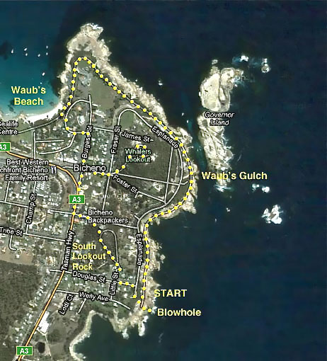
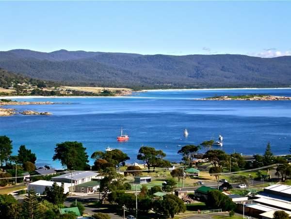
Return distance : 4 km ; Time : 2 hours Bicheno ('Bich-en-oh) is a small town on the eastern coast of Tasmania. With its rocky peninsula setting, it is a town of some character. It is possibly named after J. E. Bicheno who was Colonial Secretary in Tasmania in the 1840s. This is a pleasant scenic walk.
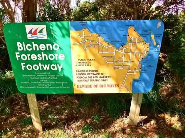
The Foreshore Footway is nicely developed and signposted.
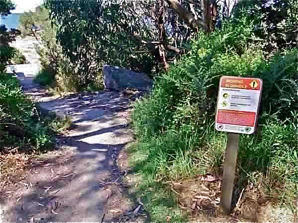
We park near the end of Douglas Street where there is a sign directing us to the Bicheno Blowhole.
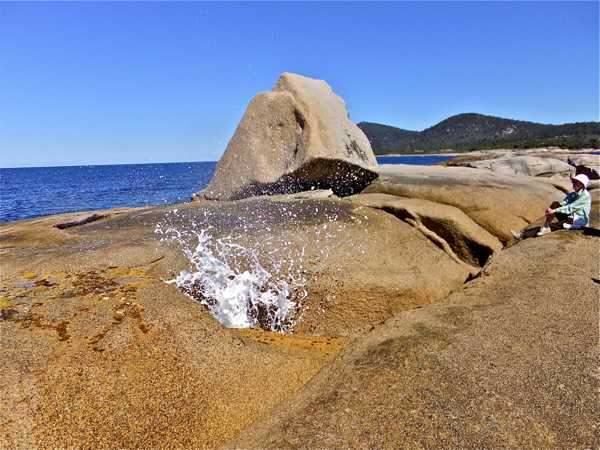
Well! You would hardly come to Bicheno to see this sight! But when the sea is rough, it is a different matter (I am told!).
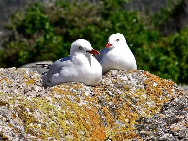
We leave the blowhole, passing a couple of sleepy gulls.
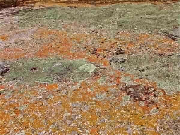
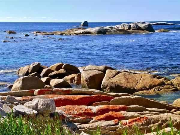
The lichen on the rockas in this area is very colourful.
In places it is almost unbelievably bright.
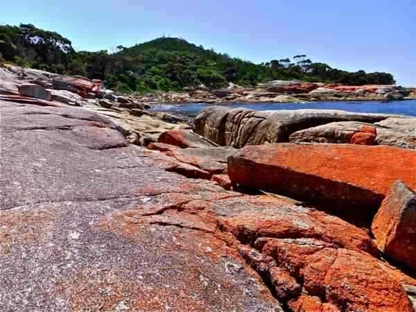
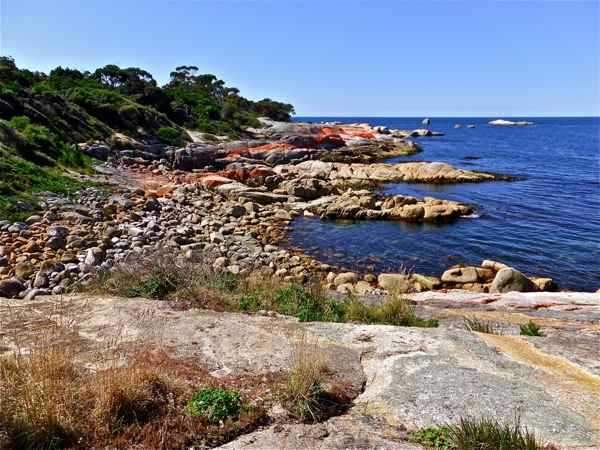
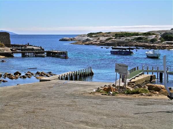
We follow the footway around towards the Gulch. The coast is very scenic.
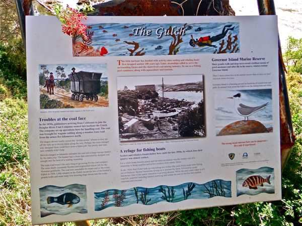
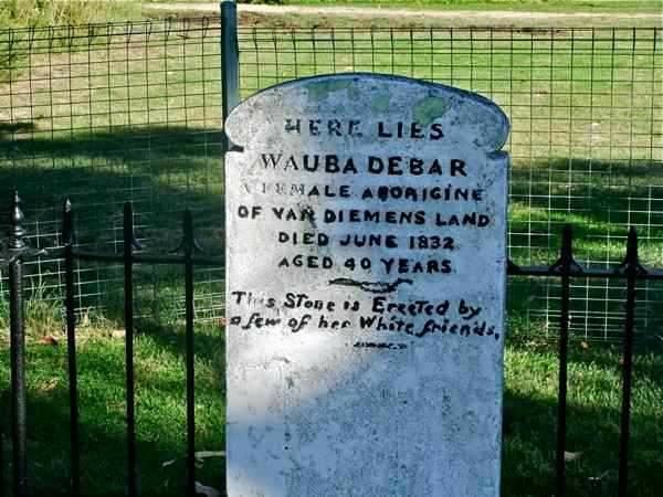
The Gulch has its own history. We might ask why the name ‘Waub’ appears here and other places.
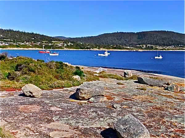
Today the Gulch is a centre for Bicheno’s fishing industry.
It also presents a barrier between the mainland and Governor Island Marine Reserve and nearby rocky islands.
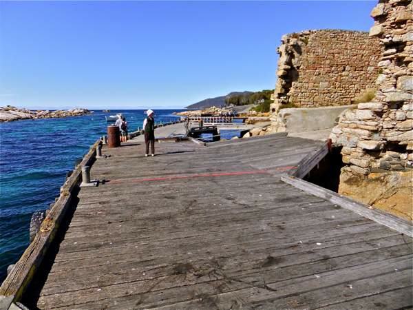
We are interested in these old stone walls, but there is no historic plaque to explain them.
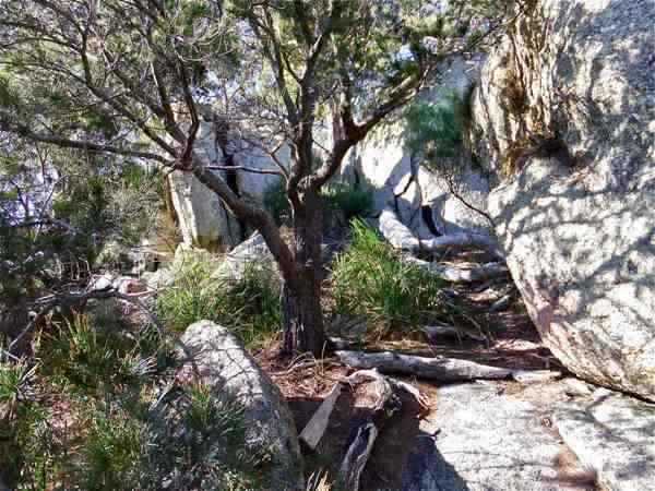
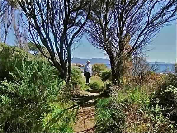
Leaving the Gulch, we follow around the point of the peninsula. The track is well marked and easy to follow.
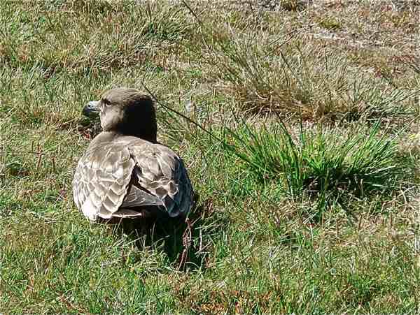
A baby Pacific gull is unconcerned by our presence.
The track leads us round until Waub’s Beach comes in sight
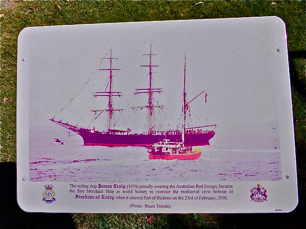
This interesting plaque commemmorates James Craig as being the first Merchant Ship in world history to exercise the mediaeval civic honour or Freedom of Entry when it entered the Port of Bicheno in 2005. Curious!
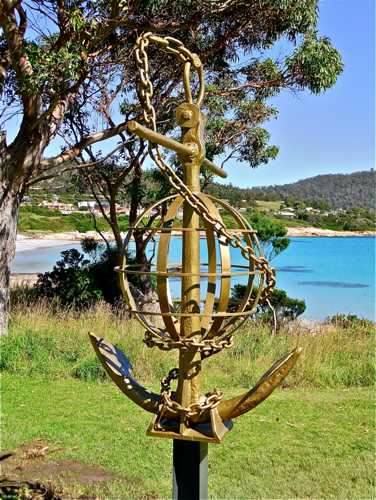
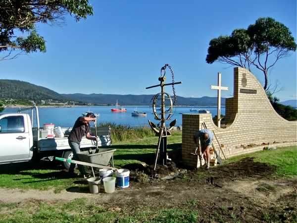
Nearby is a memorial to the Merchant Navy with this fine anchor ...
... and a curved memorial wall.
Just close by is this interesting grave and headstone. It appears that this Aboriginal lady saved a couple of white men from their sinking boat during a severe storm. It also explains the name ‘Waub’.
We walk through to the little shopping area and up Foster Street where there is a track up to the Whalers’ Hill Lookout. There are good views from here in several directions.
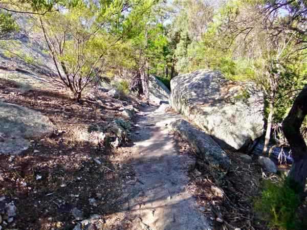
The walking track is reasonable.
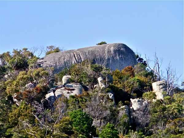
We return to Foster Street and the main highway, following it around to Marshall Street. A prominent feature looking out over the town is South Lookout Rock
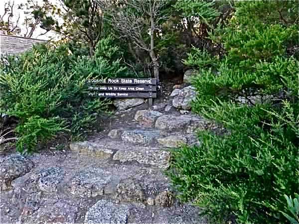
Marshall Street ends in a cul-de-sac from where this track leads off.
After a while I got lost! There are probably good views from the top of the massive granite boulder at the peak, but there is no easy way to get up there. However, it is a good place for exploring!
I came across a well-defined track leading from the other side, and followed this down, linking back to Douglas Street and our starting point. This is a pleasant, interesting and scenic walk. |
||
|
|
||
 .
.