   |
How to obtain the map |
 |
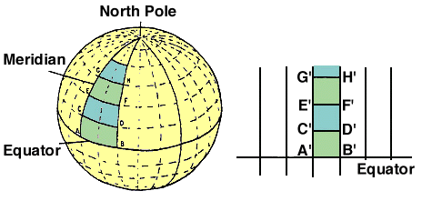
From the adjacent diagram, we see that the decreasing distances AB, CD, EF, GH, ... on the globe must appear as segments A'B', C'D', E'F', G'H', ... with the same length on Mercator’s map. In 1599 Edmund Wright showed that this hapens when lengths along latitude |